The Top 5 Uses of Aerial Maps for Landscaping
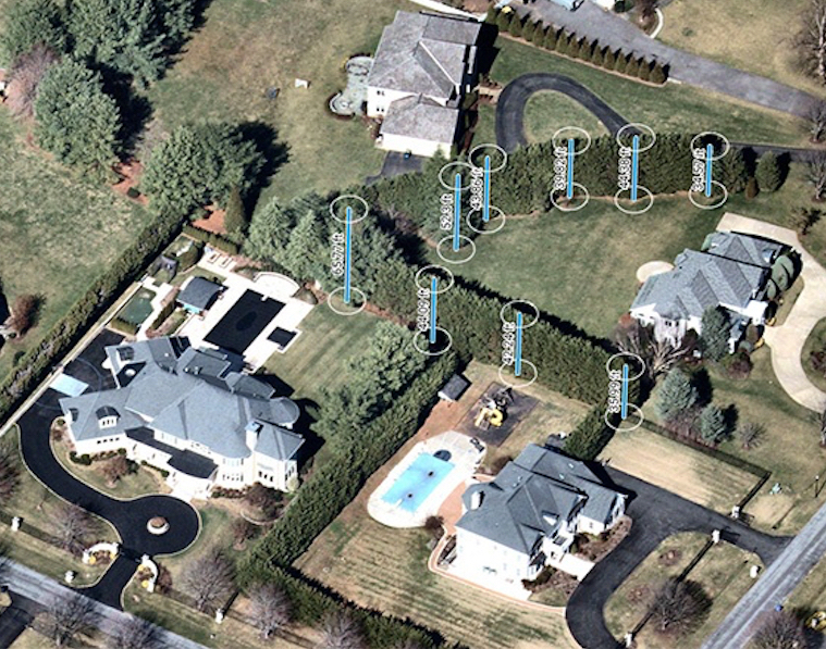
Aerial maps providing remarkable detail — clearer than satellite imagery — are an important form of location content for lawn and landscape companies designing ground features such as pools, fences, decks and vegetation of varying height. Other small businesses — such as paving, pool, roofing and solar companies that service commercial or residential properties — are also rapidly adopting this technology.
With 2.8-inch GSD aerial imagery, landscapers can measure the entire terrain and determine the needs and cost of a project. Even species of plants or trees can be discerned using these high-resolution captures. Users can measure the heights of structures from different angles and all cardinal directions. Having a clear sense of area, height and width allows for more efficient field service management.
As landscapers build their business, they typically focus on five top uses of aerial imagery to win business faster and grow their clientele:
1) Efficiently prospect for new opportunities
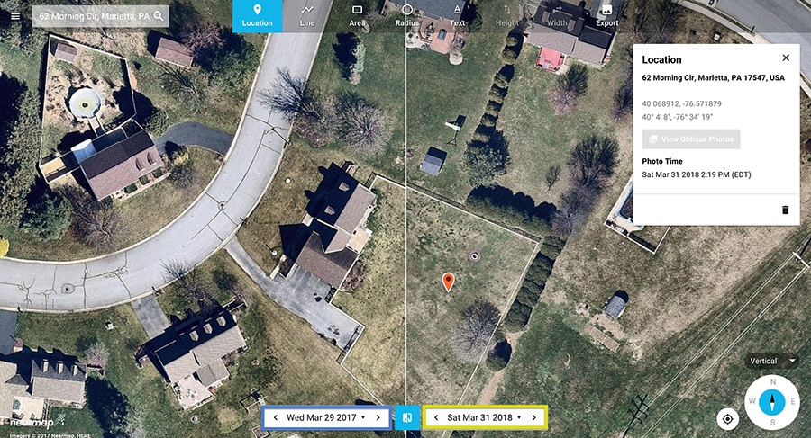
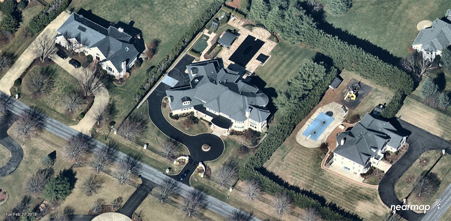
Using split view, users can compare an historical capture to a very current aerial map. In this example, March 29, 2017 is compared to March 31, 2018, a very recent image. There’s been little change over time. Prospecting for new business using high-resolution aerial maps means you don’t need to travel on site. In just minutes, landscape professionals can scan large areas of land from a birds-eye view to find potential opportunities.
2) Accurate measurements and quotes
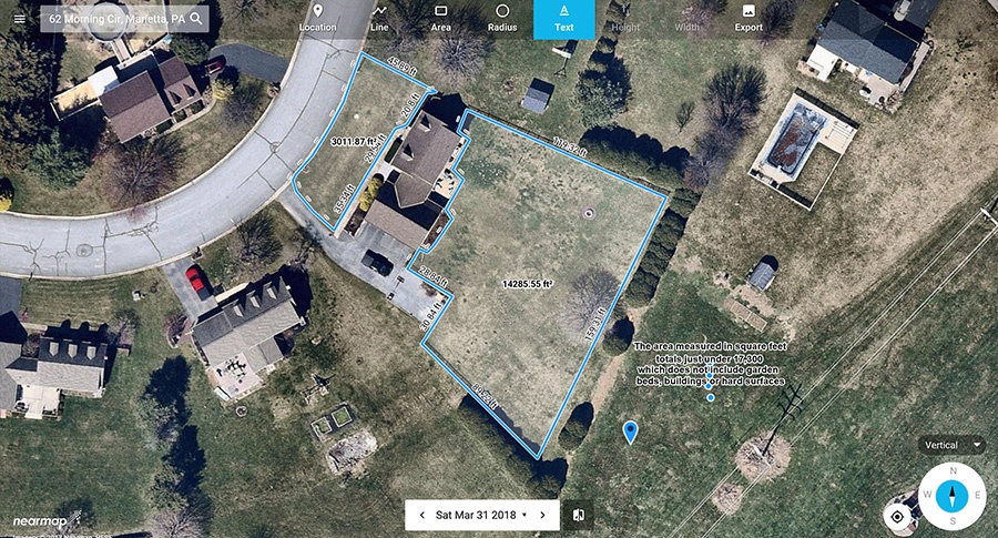
A landscaper can use include the square feet of the front and back yards while also annotating the image. Creating these types of area measurements take seconds using a set of measurement tools that include line, area and radius. Any number of “map objects” can be included in the landscaper’s analysis. In this case, MapBrowser from Nearmap was used to include the square feet for the front and back yards while also annotating the image with notes to win the business. Using spring imagery — also known as “leaf off” imagery — provides a clear way to visualize property details without obstructions impacting your measurement.
3) Create winning proposals
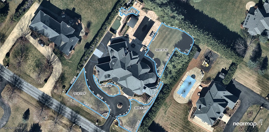
When a prospect asks for a proposal, the landscaper can locate the property, analyze, measure, annotate with a cost estimate, and export the imagery to send to the client as a proposal — all within minutes. This speed, precision and professionalism is what it takes to outshine the competition and win the job.
4) Field service optimization
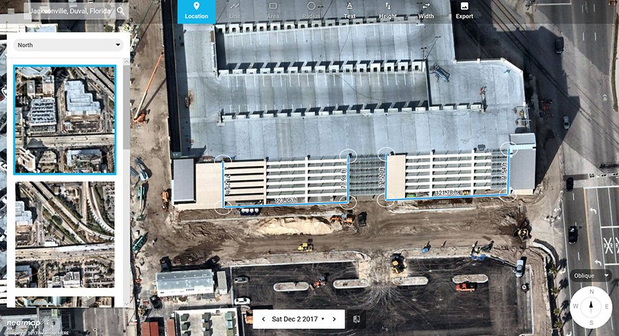
In this example, a commercial developer has called and asked for landscape services adjacent to a parking garage being completed. They have described the structure but need the landscaper to verify height, width, decide on the types of trees to install and then requisition equipment for the job.
5) Maintenance and customer satisfaction
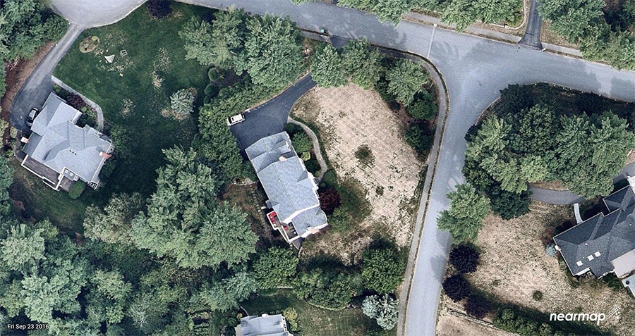
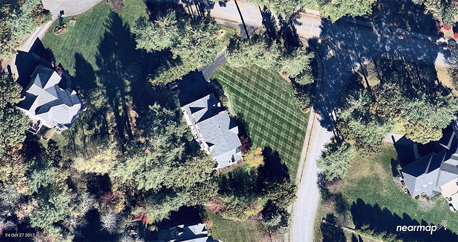
Massachusetts in the fall of 2016, and again in the fall of 2017 – for the exact same property. Notice the difference in the quality of the lawns in the center and the lower right. The landscaping services have worked well, leading to high levels of customer satisfaction. In cases when you risk a client “churning” because they claim you have not improved the lawn, you can use historical archives to clearly demonstrate the progress you are making. Historical imagery can also be compared to current aerial maps to validate or settle customer disputes. Older imagery can be used as proof that a problem on the property existed prior to job completion.
Article provided by Nearmap, a high-resolution aerial imagery provider. Nearmap’s high-resolution, frequently updated aerial imagery is 3-inch GSD, better than satellite imagery. Delivered within days of capture, Nearmap shows changes over time. Nearmap helps landscapers build their business by enabling them to prospect for new opportunities more efficiently, offer more accurate measurements and quotes, create more winning proposals, and enhance maintenance and overall customer satisfaction. For more information, visit http://go.nearmap.com

